Rainfall amounts will be significant. See graphic below.

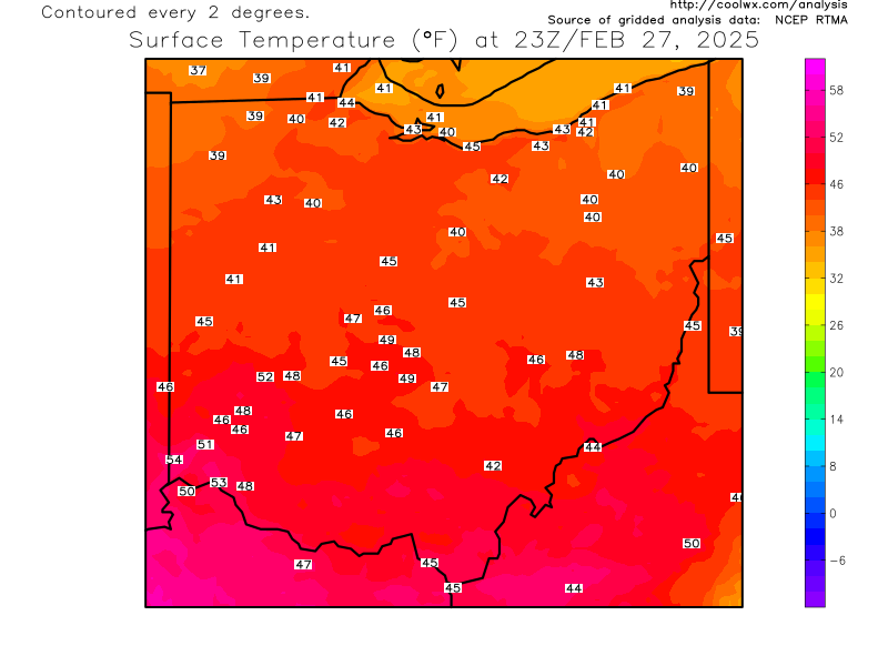
Current OHIO temperatures
Current Ohio Valley radar loop


Temps will climb into the 50s tonight and early Sunday then drop by late afternoon.


Lake Erie water temperature is 37. Typically we need an approximately 23 degree temperature difference (Fahrenheit scale) between the lake water and the air aloft (5000 foot level) for lake effect to develop. That puts the threshold at 14 degrees Fahrenheit at 5000 feet. By Wednesday of next week, the temperature will drop to -9! Again, this is all in Fahrenheit. (-22 to -25 for meteorological purposes in northern Ohio). For comparison, the "Polar Vortex" event last January had a 5000 foot temperature (850 mB) of -23.
Daytime highs might stay in the single digits Thursday according to one projection.

I hesitate to give snowfall projections this far out. But considering that the extended models have been very consistent with this arctic air or late (some too warm; some too far west with the cold), posting a preliminary snow forecast seem reasonable. TUESDAY'S CLIPPER could drop between 2-4"+ across northern Ohio.


No comments:
Post a Comment